DALUMPINAS

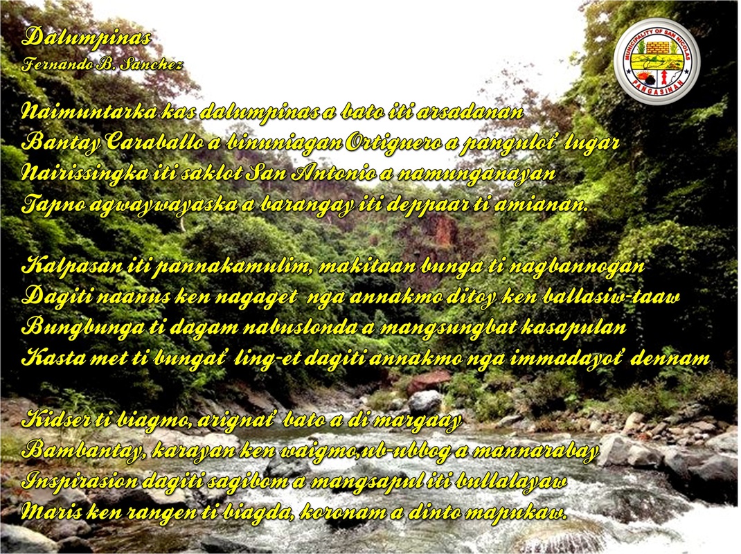

In 1916, one of the early settlers of the land identified as Dionisio Ortiguero named the area as Dalumpinas. The name was derived from a big flat rock commonly called by early settlers as “Bato” which was found on the mouth of the Dagdaguen Creek . The first Teniente del barrio was Vicente Fernandez and the second was Eliseo Martinez.
Before World War II brokeout Dalumpinas was a sitio of barrio of San Antonio. However, because of its increasing annual population rate, the late Eliseo Martinez personally initiated the passing of Municipal Council Resolution. In 1962, Sitio Dalumpinas was created and converted into a barrio.
In 1938, a primary school class was established under Mr. Manuel Pacla and later on, additional two other classes were open under Mr. Manuel Rodrigo Sr. In 1952, a complete elementary school was established and the intermediate class was held in the Gabaldon Building with Mr. Eduardo Navarro and Julian P. Martinez as the first intermediate school teacher and school principal, respectively.
Several of its inhabitants are currently employed as OCW’s in the Middle East, Europe, Hongkong, and other Asian countries and are actively extending assistance in all Barangay projects.
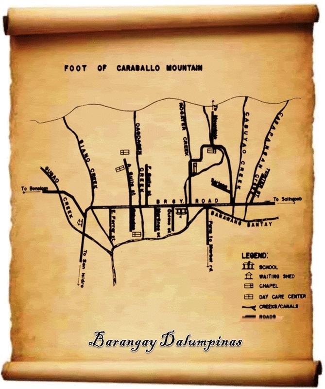
Barangay Dalumpinas is one of the biggest barangay among the thirty-three barangays of San Nicolas. It is situated at the foot of the Caraballo Mountain and more or less six kilometers away from the town proper. It is among the eighteen barangays located in the northern portion of the Ambayoan River. It is bounded in the east by Barangay Salingcob; on the south by Barangay Lungao; in the west by Barangay San Isidro; and in the north by the Caraballo Mountain. It is divided into four puroks or group namely: Purok Minong (Eastern Dalumpinas) with the total population of 497 and 102 househoulds; Purok Santos (Central Dalumpinas) with total population of 201 and 45 households; Purok Pablo (Centro) with a total population of 193 and 47 households; and Purok Prudencio with a total population of 246 and 42 households.
The Barangay has estimated total land area of more or less 250 hectares of which 200 hectares are considered agricultural lands; 20 hectares are classified as residential lands; and the remaining 30 hectares has rolling hills planted with varieties of trees and fruit bearing tress like mangoe, kasoy, and others. The principal farm product is rice supplemented by a variety of vegetable plants. It has an approximate annual farm production of 32,000 sacks of rice, four (4) to five (5) tons of cash crops. The construction of several irrigation canals by farmer associations like Tanggal Bantay, Tanggal Takip, and Tanggal Lakay, boosted the improved agricultural produced with three cropping every year.
The inhabitants of the barangay supplement their agricultural income through cattle-raising, swine-raising, and bamboo furniture making.
Before World War II brokeout Dalumpinas was a sitio of barrio of San Antonio. However, because of its increasing annual population rate, the late Eliseo Martinez personally initiated the passing of Municipal Council Resolution. In 1962, Sitio Dalumpinas was created and converted into a barrio.
In 1938, a primary school class was established under Mr. Manuel Pacla and later on, additional two other classes were open under Mr. Manuel Rodrigo Sr. In 1952, a complete elementary school was established and the intermediate class was held in the Gabaldon Building with Mr. Eduardo Navarro and Julian P. Martinez as the first intermediate school teacher and school principal, respectively.
Several of its inhabitants are currently employed as OCW’s in the Middle East, Europe, Hongkong, and other Asian countries and are actively extending assistance in all Barangay projects.
Barangay Dalumpinas is one of the biggest barangay among the thirty-three barangays of San Nicolas. It is situated at the foot of the Caraballo Mountain and more or less six kilometers away from the town proper. It is among the eighteen barangays located in the northern portion of the Ambayoan River. It is bounded in the east by Barangay Salingcob; on the south by Barangay Lungao; in the west by Barangay San Isidro; and in the north by the Caraballo Mountain. It is divided into four puroks or group namely: Purok Minong (Eastern Dalumpinas) with the total population of 497 and 102 househoulds; Purok Santos (Central Dalumpinas) with total population of 201 and 45 households; Purok Pablo (Centro) with a total population of 193 and 47 households; and Purok Prudencio with a total population of 246 and 42 households.
The Barangay has estimated total land area of more or less 250 hectares of which 200 hectares are considered agricultural lands; 20 hectares are classified as residential lands; and the remaining 30 hectares has rolling hills planted with varieties of trees and fruit bearing tress like mangoe, kasoy, and others. The principal farm product is rice supplemented by a variety of vegetable plants. It has an approximate annual farm production of 32,000 sacks of rice, four (4) to five (5) tons of cash crops. The construction of several irrigation canals by farmer associations like Tanggal Bantay, Tanggal Takip, and Tanggal Lakay, boosted the improved agricultural produced with three cropping every year.
The inhabitants of the barangay supplement their agricultural income through cattle-raising, swine-raising, and bamboo furniture making.
|
Summary:
Barangay Population No. Of households Land Area Distance from Municipal Facilities Road Condition Public utility Vehicle Source of Potable water Source of Electric Power Mineral Resources School Farm products |
: Dalumpinas : 1,211 (2000 census) : 242 (2000 census) : 250 has. : 1kms. : Day Care Center/ Basketball Court : Graveled : Jeep/ Tricycle : Shallow Well/Deep Well : Spring Developed : PANELCO III : Dalumpinas Elementary School : Dalumpinas National High School : Palay/Corn |

San Nicolas Municipal Library
Your Information...
Your Connection...
Your Link...
Your World!
Your Information...
Your Connection...
Your Link...
Your World!
 |
 |
 |
